On foot
Climb it
Dark start, summit at first light
- RouteThe summit trail
- Walking time5 hours listed
- StartWell before dawn
Place it on the map
13 places to see
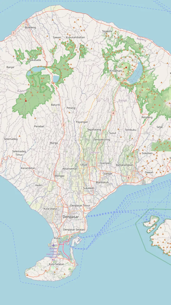
An active volcano of 1,717 m at the centre of two concentric calderas.
Google MapsA pickup area on the site tour's listing; the car ride is listed as 2 hours.
Google MapsA pickup area on the site tour's listing, and a meeting point on another listing.
Google MapsA pickup area on the site tour's listing, and a listed drop-off.
Google Maps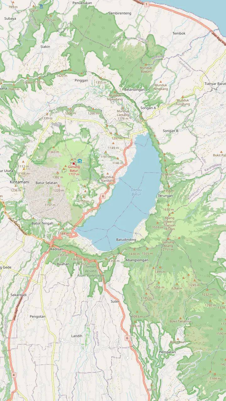
The summit stands at 1,717 m, with a 700 m active cone above Lake Batur.
Google MapsThe site tour's listing names a meeting point near Mt. Batur; the listings' start is in Songan A, Kintamani.
Google MapsAn active caldera lake at 1,050 m with a 16.05 km2 surface and an average depth of 50.8 m.
Google MapsOne of the four main villages inside the caldera.
Google MapsThe lakeside village from where a motorboat crosses to Trunyan in about 30 minutes.
Google MapsA Bali Aga village on the east shore, usually reached by boat, where the dead are laid on the ground and not cremated.
Google Maps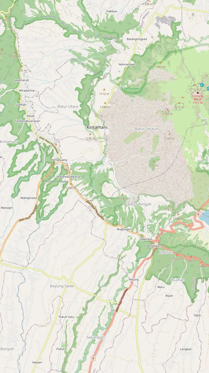
The town on the southwest ridge of the caldera, from where the 1963 lava field can be seen.
Google MapsThe second most important temple complex in Bali after Pura Besakih.
Google MapsIts name means place to look; Mount Batur, Lake Batur and the Black Lava share one frame.
Google MapsMount Batur is a restless cone in the middle of a much larger crater in northeast Bali, with a crescent lake at its foot and a trail people climb in the dark to see the sun come up.
The compact version
The Mount Batur volcano is the summit most people mean when they say Batur, and it stands 1,717 m above sea level.1,8 UNESCO calls that a modest height, then adds that the mountain is among the most beautiful in the region because of its double caldera, the crescent of its lake and the sunrise views that hikers enjoy.8 The number worth keeping in mind for a trek is that this is no alpine climb, yet it is high enough for the air on top to be very cold before the sun is up.9
The mountain sits at the center of two concentric calderas. The larger one measures 10 by 13 km and holds a lake on its southeast side; it formed when a magma chamber collapsed about 29,300 years ago, and the inner caldera collapsed about 20,150 years ago.3 What you climb is the cone that grew afterward inside the younger crater, an active stratovolcano about 700 m tall rising above Lake Batur.10 Seen from the rim, the layers are easy to read: a wall, a basin, a lake, and then the cone.
A geopark has been drawn around all of it. The Batur Geopark describes its area as two calderas with caldera walls, cones and craters, and UNESCO says the geopark spans 15 villages of the Kintamani district in Bangli Regency.11,12 The same UNESCO text says the volcano is believed to have formed less than 30,000 years ago.13 So the thing you are looking at is young by geological standards, and still being shaped.
The numbers
| Feature | Figure | What it tells you |
|---|---|---|
| Summit | 1,717 m | An active stratovolcano cone |
| Lake surface | 1,050 m | A caldera lake below the rim |
| Lake area | 16.05 km2 | Average depth 50.8 m |
| Large caldera | 10 by 13 km | Collapsed about 29,300 years ago |
| Villages | 15 | Inside the geopark's Kintamani district |
| Shoreline | 21.4 km | All the way round Lake Batur |
Batur is not extinct and no source we read pretends otherwise. UNESCO counts at least 22 eruptions between 1804 and 2000, and the first documented eruption was in 1804.13,2 The most recent one on record was in 2000.2 A sunrise trek is nonetheless a routine outing: tourism in the caldera has grown because the trek to the summit is relatively straightforward.15
Monitoring is part of the geopark's work. It runs museum visits with PVMBG, Indonesia's volcanology center, where students learn how volcano monitoring works at the observation post.16 None of the sources we read publishes a live alert level for the summit, so the sensible habit is to read your operator's messages the evening before and treat a changed plan as their call, not a fault.
Where the lava went is easy to see. The 1963 flow still shows as a dark field when you look across from Kintamani, and Indonesia.travel describes the Black Lava as an expanse of black volcanic rock and sand left by frozen flows.10,17 Jeep and dirt-bike outings run across that ground, which is a different morning from the one this site covers, so we only point at it here.
Heights
Lake Batur is an active caldera lake at 1,050 m with a surface of 16.05 km2 and an average depth of 50.8 m.4 Set the lake against the Mount Batur elevation and you get the scale of the cone above it. Its shoreline runs about 21.4 km; the volcano rises on its western side, while steep hills and Mount Abang, at 2,172 m, close in on the north, east and south.1 UNESCO measures the crescent of the lake at 7 km long and 1.5 km wide.21
Indonesia.travel dates the lake to an eruption about 29,000 years ago and says you can rent a traditional boat to reach the middle or just sit by the dock.22,23 The same page suggests tilapia from the lake's farms, Kintamani Ayam Betutu and Kintamani Arabica coffee, known for a citrus aroma, as lunch choices.24 It is a quiet place after a very early morning.
Trunyan, on the east shore, is the village most visitors cross the water to see. The geopark puts it about 5 km from Kedisan, 32 km from Bangli city and 70 km from Denpasar, usually reached by boat, and the crossing from Kedisan takes about 30 minutes.25,20 Its people lay the dead on the ground under a white cloth and a bamboo lid instead of cremating them, a tradition called mapasah.26 It is a lived-in village, so ask before photographing anyone.
Sort by wish
Say what you want from the mountain and see the match.
If I want the sunrise from the summit
Climb it
If I want the view without the climb
The Penelokan rim
If I want a sunrise with no hiking
Pinggan Village
If I care about the sacred side
Ulun Danu Batur temple
If I am curious about village customs
The boat to Trunyan
Three approaches
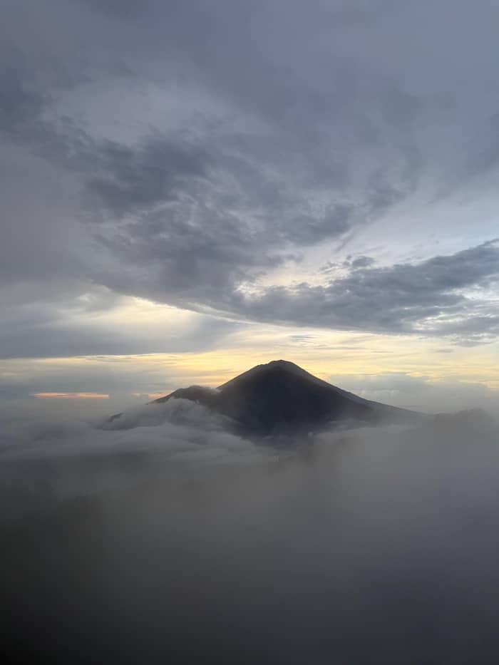
On foot
Dark start, summit at first light
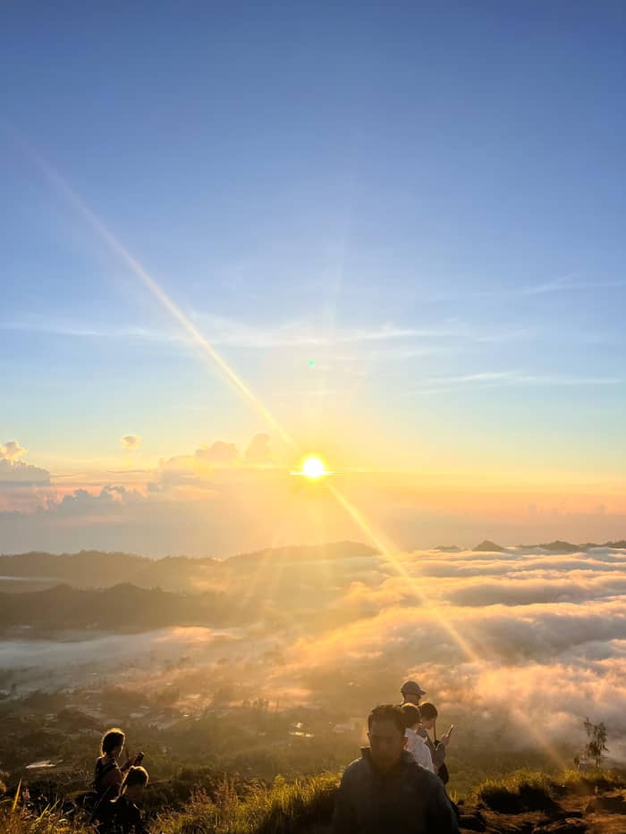
By car
From the rim at Penelokan
On water
By boat to Trunyan
To the Balinese, Batur is not just a viewpoint. The Batur Geopark Museum explains that Mount Batur and Mount Agung hold special significance, with Agung as the embodiment of Purusha and Batur of Pradhana, two forces that work together to give fertility and prosperity.5 Read that way, the crater is a place of belief before it is a place for photographs.
The lake and the mountain have a temple of their own. Pura Ulun Danu Batur is the second most important temple complex in Bali after Pura Besakih, dedicated to Lord Vishnu and the Goddess Danu in gratitude for the lake's water.19 The temple's Ngusaba Kedasa is a tenth-month ritual aimed at agricultural fertility, the nation and world peace.31
Visitors are asked to behave accordingly. Bali's Circular Letter Number 7 of 2025, issued on 24 March 2025, mandates modest and appropriate clothing for foreign tourists at sacred sites, and bars them from the main and middle sections of holy places except to pray.32,33,34 Your guide can tell you where the line falls on a given morning; follow it without arguing.
From the collapse to the geopark
About 29,300 years ago
The magma chamber gives way and leaves the 10 by 13 km basin.3
About 20,150 years ago
A second collapse draws the smaller crater inside the first.3
1804
Written records of Batur's eruptions begin with this year.2
1804 to 2000
UNESCO counts at least 22 between these two years.13
1963
The 1963 flow is visible from Kintamani on the southwest ridge.10
2000
No later eruption is recorded in these sources.2
2012
The Global Geoparks Network certificate for the Batur caldera was issued on 20 September 2012.14
The caldera is lived in. It has 15 villages, of which Kedisan, Songan, Trunyan and Toya Bungkah are the four main ones, and local people largely rely on agriculture, with tourism growing as the summit trek became popular.15 UNESCO names Kintamani sweet oranges, civet coffee, wooden crafts and bamboo carvings among the area's products.12
The geopark explains why coffee does well here: the coolness, the fertility and the heights of Kintamani-Bangli suit it, and plants are managed with organic or natural fertilizers and few pesticides to keep the quality and taste.35 The area also gave its name to the Kintamani dog, a breed that originates in these mountains and has long been bred for a brave nature.36 If your morning ends at a coffee plantation, you are tasting the same ground you just walked.
The geopark label is recent but not new. On 20 September 2012 UNESCO issued the Global Geoparks Network certificate for the Batur caldera, and the Indonesian energy ministry noted that the area is reviewed every four years.14 UNESCO's own page lists a sunrise hike of Mount Batur, the subak irrigation system and the thermal waters at Lake Batur as things to do.37
Video
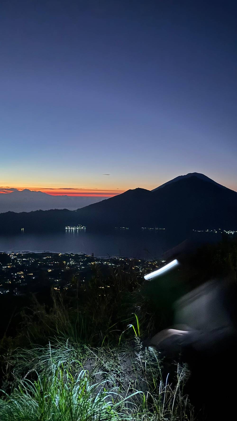
Mount Agung is considered the embodiment of Purusha (male), and Mount Batur is considered the embodiment of Pradhana (female).
Carry this with you
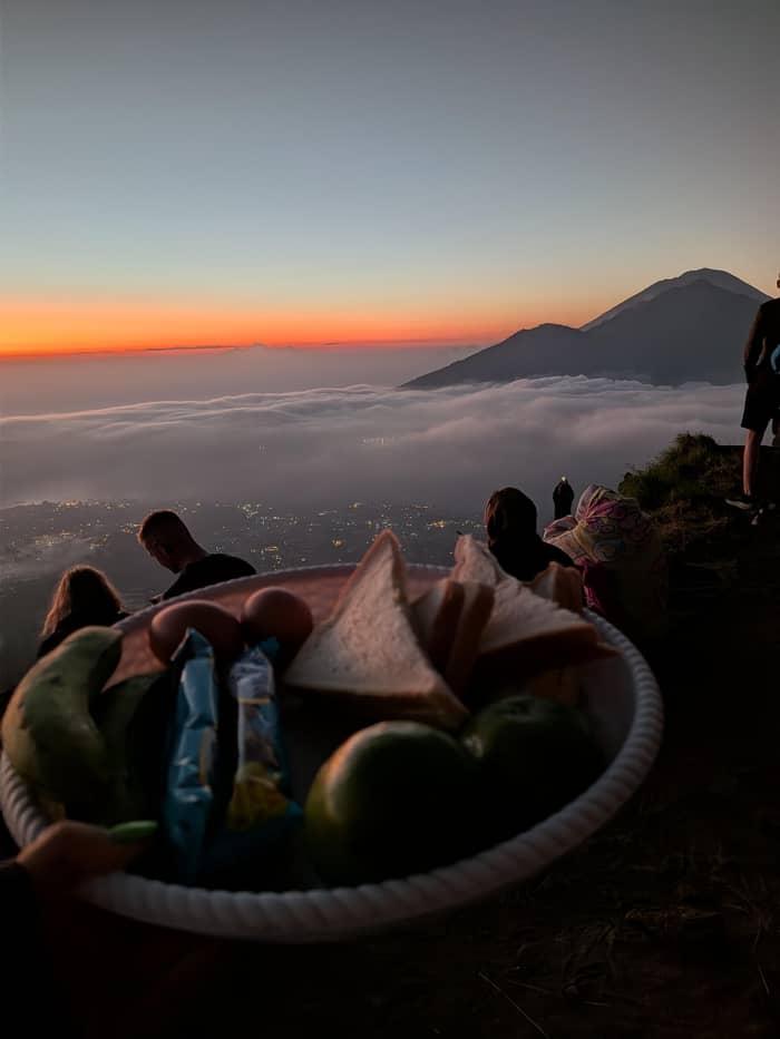
The usual way is the trek, and the Mount Batur height is the first thing a guide mentions at the base. On the site tour's listing, the car ride is 2 hours, the walk on Mount Batur is 5 hours and there is a 30-minute break at Kintamani. The Love Bali portal of the Bali Provincial Government, by contrast, describes a two-hour hike up the mountain for the first rays of sun with Mount Abang and Lake Batur behind.6 The two figures differ, so treat both as rough and read the listing you book.
Timing matters more than fitness. Indonesia.travel gives May to September, the dry season, as the best time for clear views, recommends July and August for sunrise, and advises arriving between 06:00 and 10:00 for the best views from the rim.38,39 The geopark puts the rainy season from December to May, with 1,838.60 mm of rain in an average year.40 No sunrise is guaranteed in either season.
If climbing is not for you, there are other ways to take in the view. Indonesia.travel names Pinggan Village as a place to watch the sun come up over a misty valley without hiking, and describes Penelokan as the spot for an all-encompassing view where Batur, the lake and the Black Lava share one frame.18,7 Our pages on the trek's timeline, its price, pickup and the weather pick up from here.
FAQ
It also mentions a sea of clouds over the caldera, though no sunrise view is guaranteed.41
The geopark museum describes Batur as the embodiment of Pradhana, paired with Agung as Purusha.5
Sources
Unsure about the 2 AM start? Ask us here.